Chapter: 17. Globes And Maps
Chapter 17: Globes and Maps - Your Self-Study Guide
Welcome to your guide on Globes and Maps! This chapter will help you explore how we understand our amazing Earth using special tools.
What You Will Learn
What a globe is and how it helps us. What a map is and why it’s so useful. How to understand and use directions. The important features you find on every map. How to locate different places using maps.
Key Terms to Remember
Here are some important words you will learn in this chapter:
Globe: A round model of the Earth. Map: A flat drawing of the Earth or a part of it. Directions: Ways to show where something is (like North, South, East, West). Grid: A pattern of lines on a map that helps find places. Cartography: The art and science of making maps.
Getting Started: Thinking About Our Earth
Imagine long, long ago, some people thought the Earth was flat! They might have thought if you traveled too far, you’d fall off the edge.
Think about it: If the Earth were flat, how would it look? Maybe like a giant pancake or a big flat board? To truly understand the Earth’s shape and where everything is, we use special tools: globes and maps.
Globes
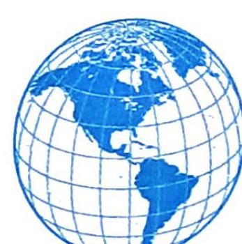
A globe is like a miniature version of our Earth. It’s a round model that helps us see the Earth’s actual shape.
The true shape of the Earth (it’s round, like a sphere!). Where continents, countries, oceans, and seas are located. Different places on Earth. Why a Globe is Not Always Useful: Hard to Carry: It’s heavy and difficult to take with you everywhere. Limited Detail: To show small areas like a town or a city in detail, a globe would have to be incredibly huge! Not flat: You can only see half of the globe at one time. Maps
A map is a flat drawing of the entire Earth or just a part of it. Maps are usually drawn on paper or any flat surface.
They are flat, making them easy to carry and use. They can provide much more detailed information about a specific place than a globe can. Road Maps: Show roads, important landmarks, and buildings. Digital Maps: Maps you can see on screens, like on your phone or computer. Atlases: A special book that is filled with many different maps is called an atlas. Green Earth Connection: Thematic Maps An atlas often includes thematic maps. These maps focus on specific topics like: Threats to the environment. Carbon footprints (how much greenhouse gases countries produce). The effects of climate change on different countries. Maps vs. Globes: A Quick Look
Here’s a comparison to help you understand the main differences:
Are drawn on a flat surface. Do not show the true spherical shape of the Earth. Are easier to use and can be taken anywhere. Show more details about places. Are round models of the Earth, not flat. Show the actual spherical shape of the Earth. Are heavy and difficult to carry to different places. Show fewer details than maps.
Features of a Map
Every map has special parts that help us understand the information it presents. These features include directions, scale, colours, symbols, and grids.
Directions
Directions tell us where a place is located on a map.
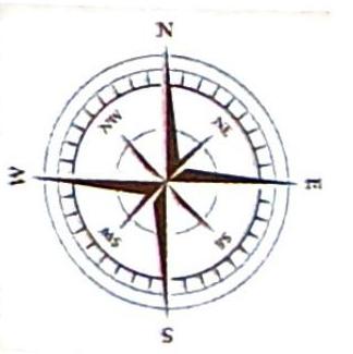
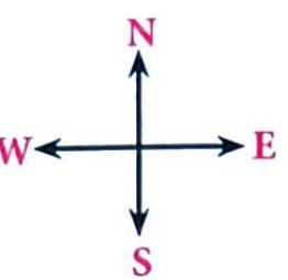
North on Maps: A map is usually drawn with the north direction at the top of the page. This is often shown by an arrow pointing north. Finding Other Directions: If North is at the top, then South is at the bottom. If you face North, East is to your right. If you face North, West is to your left. Cardinal Directions: These are the four main directions: Intermediate (Ordinal) Directions: These are the directions in between the cardinal directions: Using a Compass: A compass is an instrument that helps us find directions. It always points towards the north. Once you know where north is, you can figure out all the other directions. To remember West (W) and East (E) when North is at the top, think of WE (West on left, East on right). Can you create your own fun ways to remember N, E, S, W? Understanding Cartography (Factpedia): Cartography is the special art and science of making maps. A cartographer is the person who makes maps.
Colours
Maps use standard colours to represent different physical features of the land:
Blue: Water bodies (like oceans, lakes, rivers). Brown: Mountains and highlands. Orange: Plateaus (flat elevated land). White: Snow-topped areas. Green: Lowlands and plains (flat, low-lying land).
Scale
The Earth is huge, but maps are small! A scale helps us understand the real distance on the ground compared to the distance shown on the map.
Purpose: To reduce a large area of land to fit on a page or screen while still showing accurate distances. What it Shows: The relationship between a distance on the map and the actual distance on Earth. Location: Scales are usually found at the bottom of a map.
Symbols
Maps use small pictures or designs called symbols to represent different objects or features in the real world. This helps to show a lot of information without using many words.
What Symbols Represent: Cities, roads, railway lines, airports, forests, hospitals, and many more. Key or Legend: To understand what each symbol means, maps have a key or a legend. This is a small box, usually in the corner of the map, that explains each symbol used.
Grid
When you look at a map, you will often see lines crisscrossing it, running from north to south and from east to west. These lines form a grid.
How it Works: Each line on a grid has a number or a letter. Purpose: The grid acts like a coordinate system and helps you pinpoint and locate places very accurately on a map. Activity: Practicing Locating Places
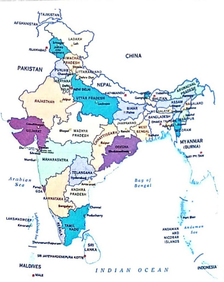
Look at the map of India. Use the cardinal and ordinal directions to describe the location of different cities in relation to New Delhi, the capital of India.
Bengaluru’s direction from New Delhi. Mumbai’s direction from New Delhi. Srinagar’s direction from New Delhi. Kolkata’s direction from New Delhi. Chapter Summary
Here’s a quick recap of what you’ve learned in this chapter:
A globe is a spherical model of the Earth, showing its true shape and general locations. A map is a flat drawing of the whole or a part of the Earth, offering more detail and portability. A book of maps is known as an atlas. The key features of a map are directions, scale, colours, symbols, and grids. The four main cardinal directions are North, South, East, and West. The ordinal directions are found between the cardinal directions: North-East, North-West, South-East, and South-West.
 Self Study
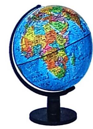
A globe
A globe


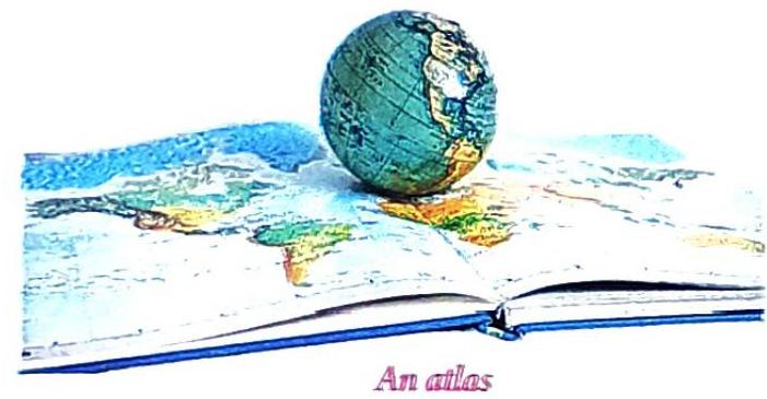
An atlas
An atlas




A grid system
A grid system
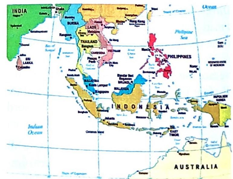
Grid on a map
Grid on a map


