Skip to content
01. Maps And Diagrams
 Self Study
Prepared by: learnloophq@gmail.com
Last edited 43 days ago by Learn LoopHQ.
Chapter: 01. Maps And Diagrams
Understanding Our World: Maps, Globes, and Diagrams
This chapter will help you explore different ways we can understand and show the Earth’s features. By the end of this journey, you will be able to:
Getting Started: Visualizing Your World
Let’s start by thinking about how you would show someone the way.
Imagine you need to tell your mother how to get from your house to your friend’s house for a class project. How would you show her the route? You could draw a simple picture, perhaps using different colors and symbols for places like shopping centers, parks, hospitals, or bus stops along the way. This simple picture is a lot like some of the ways we represent the Earth!
There are many ways to show the Earth and its features, such as maps, globes, sketches, plans, and diagrams. We’ll learn about each of these in this study guide.
Mindmap: Introduction

MAPS
A map is a drawing of the whole Earth or a part of it, shown on a flat surface.
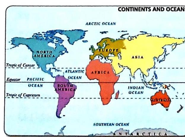
A map showing the continents and oceans of the world
A map showing the continents and oceans of the world
Mindmap: Maps

GLOBES
A globe is a model that looks like the Earth’s actual shape, a sphere, with a map of the world printed on its surface.
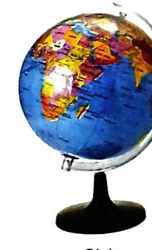
A Globe
A Globe
Pause and Think: Location Comparison
Try to find the United States and Japan on a globe and then on a world map. On a globe, they might seem quite close, but on a flat map, they appear very far apart, at opposite ends. Why do you think this happens? Think about how a sphere (globe) is different from a flat surface (map).
Mindmap: Globes

Differences Between Maps and Globes
Maps and globes are both useful, but they have key differences:FeatureMapsGlobesPortabilityEasy to carry.Difficult to carry around.Area ShownRepresent a part or the whole of the Earth.Show the whole Earth.DimensionA two-dimensional representation of the Earth or a part of it.The most accurate three-dimensional representation of the Earth.Accuracy of SurfaceThe curved surface of the Earth cannot be represented accurately on a flat surface.Its curved surface is a true representation of the Earth’s surface.Detail LevelUse different signs, symbols, and colors to provide distinct information.All details cannot be marked on a globe.
Mindmap: Maps vs. Globes

SKETCHES
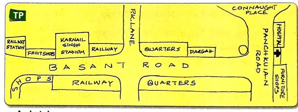
A sketch is a rough drawing that shows where a few chosen features in an area are located relative to each other.
Mindmap: Sketches

PLANS
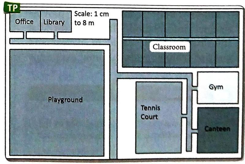
A plan is a drawing that shows the horizontal view of a small area or a building. It is always drawn to scale.
Both show an area, just as it would look when seen from above.
Both show an area, just as it would look when seen from above.
Differences Between Sketches and Plans
Sketches and plans both involve drawings, but they have important distinctions:FeatureSketchPlanBasisDrawing based on memory of a location.Diagram showing a layout, drawn to scale.Scale AccuracyNot drawn to scale, not always accurate in showing distance.Distance between places is based on scale, always accurate.Detail LevelGenerally lacks details.Shows more details.UnderstandingSometimes difficult for people who didn’t make it.Easy for all to understand.
Mindmap: Plans and Sketch vs. Plan

Importance of Maps
Maps are very important for many reasons:
Think About It: Sketch and Area Size
Do you think a sketch can give us a correct idea of the size of an area? Why or why not? (Hint: Remember what a sketch doesn’t show accurately.)
Mindmap: Importance of Maps

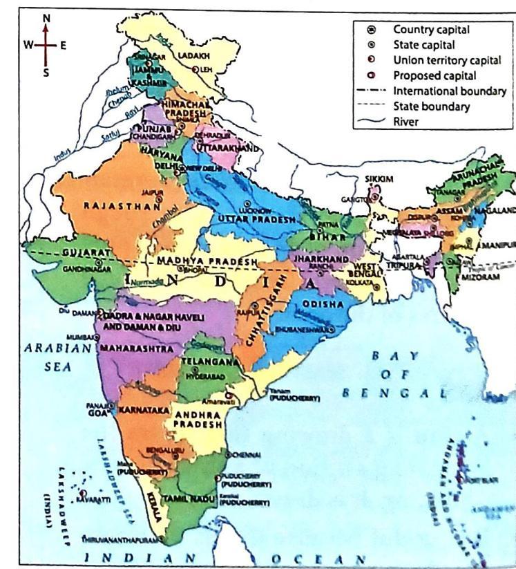
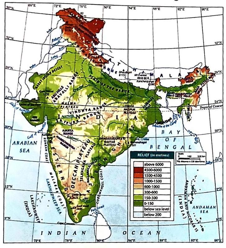
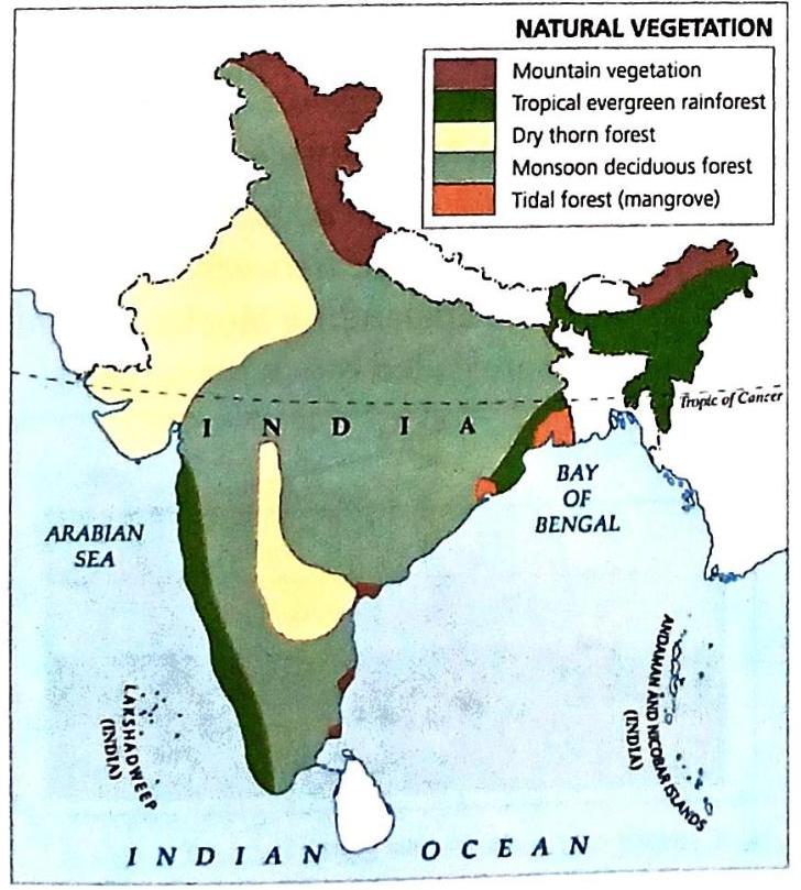
Types of Maps
Maps can be categorized in different ways, either by the level of detail they show or by the scale used to draw them.
Types of Maps Based on Details Shown
Depending on the kind of details they present, maps can be divided into four main categories:
Mindmap: Types of Maps (Details)

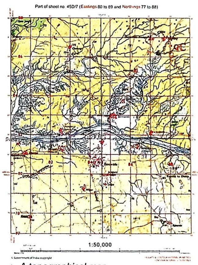
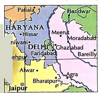
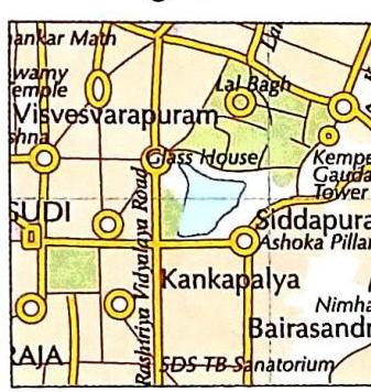
Types of Maps Based on Scale
Maps are also categorized by the scale used to draw them:
Quick Fact: Cartography
The skill or art of drawing or making maps is called cartography. This word comes from two French words: carte, meaning “map” or “card,” and graphie, meaning “representation” or “description.”
Knowledge of India: Survey of India (SOI)
The Survey of India (SOI) is the oldest scientific department of the Government of India, established in 1767. It operates under the Department of Science and Technology. The SOI is India’s national organization for surveys and mapping. Its important job is to map the entire country and mark India’s external boundaries.
Quick Fact: Atlas Index
An atlas usually has an index at the back. This index lists the names of all important places along with their latitude and longitude (coordinates that help you find them on the map).
Mindmap: Types of Maps (Scale) & Related Facts

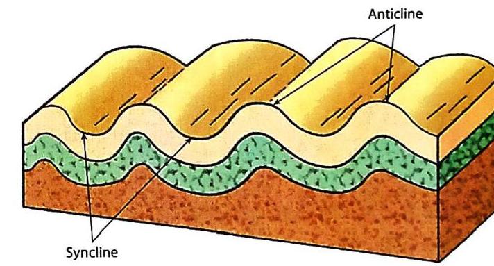
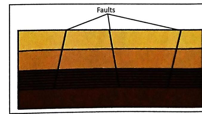
REPRESENTATION OF GEOGRAPHICAL FEATURES THROUGH DIAGRAMS
We also use diagrams to show different geographical features.
Anticline and Syncline
Block Mountains
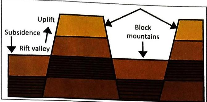
Mindmap: Diagrams - Folds and Mountains

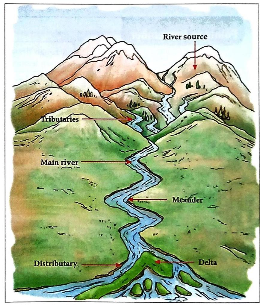
Key River-Related Terms:
Rivers, Tributaries, Distributaries, Meanders, and Deltas
Mindmap: Diagrams - Rivers

Putting Knowledge to Use: Giving Directions
Imagine a younger student from your school, who lives in your building, asks you for directions to the neighborhood market to buy stationery. How would you help them?
Think about how you could draw a simple sketch for them, marking major locations and streets in between. You could also point out any busy roads to avoid. Think about using a scale (even if just a rough idea), symbols, and directions on your sketch. How would it feel to guide someone you know?
Biography Spotlight: James Rennell (1742-1830)
James Rennell was a British geographer, surveyor, and oceanographer. He is often called the ‘Father of Indian Geography’ because of his significant work in mapping and understanding India’s geography. He carried out extensive surveys and mapping, especially in the Bengal region. His detailed maps of India were among the first accurate representations of the area’s geography, including its rivers and coastlines. His famous works include Memoir of a Map of Hindoostan (1788) and Bengal Atlas (1781).

Mindmap: Values and Biography

Key Terms
Here are some important words you learned in this chapter:
Overall Summary: Points to Remember
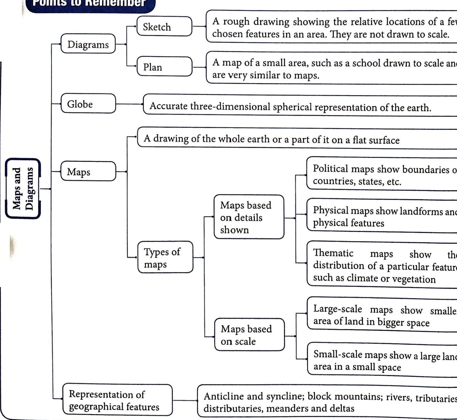
This image summarizes the main points of the chapter:
This image summarizes the main points of the chapter:
Mindmap: Overall Summary and Key Terms

Want to print your doc?
This is not the way.
This is not the way.

Try clicking the ⋯ next to your doc name or using a keyboard shortcut (
CtrlP
) instead.